Route signs are shown on maps and markers and are useful because they allow you to stay on a particular road for navigation purposes even when that road might have several different names.
All routes are numbered, although most have formal or local names, too.
The old system
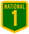
National highways are denoted by a green shield with a flat top, gold border and gold writing.
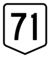
National routes are denoted by a white shield with a flat top, thin black border and black number. In general, odd-numbered highways travel roughly north-south and even-numbered highways travel roughly east-west, with a couple of exceptions. National route 1 is the road that links all capital cities and coastal towns, circumnavigating the mainland.
National highways and national routes are being phased out, although you still might see signs on some roads.
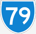
State routes, denoted by blue shields markers with a white border and white writing, are also being gradually phased out, except in Melbourne. However, you will still see them on signs, e.g. Narellan to Camden is State Route 89 and also Tourist Route 12 (see below)


The new system
Alphanumeric route numbering is a more consistent way of marking a road’s grade. Many routes adopted their previous number, but are now prefixed with a grade: M for motorways that are at least dual carriageway, high quality highways; A routes are primarily good quality single-lane highways but with frequent sections with passing lanes; B routes are secondary highways of lesser importance, but are still sealed; C routes are roads linking smaller settlements that could be poor quality and might not have shoulders, or could be bypassed sections of former A routes.


Tourist routes
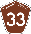
Tourist routes are denoted by a brown shield with a pointed top, the words ‘Tourist Drive’ at the top in white, and a white number.

